

'Black and white'
Motoryacht 'Kamalaya' is currently cruising around Greenland, much to the delight of Captain Christoph Schaefer and his crew. Part way through their trip, Captain Schaefer shares some of the highlights of cruising this off-the-beaten track destination.…
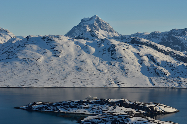
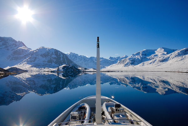
It is with relief that we pull into Arsuk Fjord and anchor off the abandoned mining town of Ivittuut. The high mountains of the fjord will protect us well from any winds howling up the Davis Strait. We are at 61 North and 48 West. It is not the furthest I have been north on a yacht, but compared to the sheltered waters of the Baltic Sea this is a different place. It appears void of any colour - just black and white.
The next morning we sail the three hours north to Evighedfsford. Mount Atter, western Greenland's highest mountain lies there. The clouds start thinning out and for the first time we get an idea of just what we might see once the sky turns blue. We wake up to an incredible sight that no words can do justice. There is not a sound to be heard, not a single vapour trail in the sky of an aircraft overhead. It feels like we have arrived at the very end of the world – we are at one of the worlds most magical places: Eternity Fjord.
Charts and Navigation
We bought MaxSea Professional and loaded Danish charts onto the system. Further to that we bought all the Danish paper charts for Greenland, which proved to be excellent. There have been extensive surveys conducted in the last few years and I found to my relief that all the areas that we visited have been recently surveyed, with many detailed charts available.
The Transas system, which I was advised was painfully inadequate, proved to be actually quite good. Running MaxSea as an independent system with a different chart source parallel did feel right, though. I can highly recommend this solution.
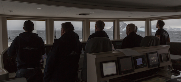
Ice Navigation
The best ice charts can be found through the Danish Meteorological Institute and through the Canadian Government Site. The ice chart symbology you can get from the NOAA site.
I have to admit that my anxiety level regarding ice navigation was relatively high until we arrived in Greenland. Arriving in early June after a long cold winter the ice had not cleared as much as it usually did. While ice is a real issue, it is pretty much self explanatory and you will feel when you can move in and when it is smart to turn around. We never had any issue with anchoring and suddenly having ice drift down on us, although this is something that can happen and of course the lookouts need to be more vigilant than in most other cruising areas. I did find that even during times of relative high ice concentrations it was easy enough to avoid any growlers and ice bergs. The chances of picking up growlers on the radar are not good but we did get quite good at it in the end.
Originally on departure from St Johns we fitted high powered spot lights on the forward mast and bow but never used them - I feel the yacht's standard spot light is sufficient. By the time we reached 61N in early June we never had any issues with it being too dark to spot growlers. While it is not light, it is never really dark.
Contacts
Our point of contact was Hans Solmssen of Mountain Adventures based out of Verbier, Switzerland, mobile: +41 79 446 2289. Hans organised all of our tours and he works together with Arne Hardenberg, mobile: +299 554500 and Adam Mike Kjeldsen, mobile: +41 79 446 2289 of SuperyachtGLOBAL. Adam was our first point of contact in Greenland and was of invaluable in helping us get set up, organising taxis, taking us to the right shops etc.
A helicopter was chartered through Greenland Air. The point of contact at Greenland Air Charter is Toke Brødsgaard, telephone: +299 34 31 46. We also chartered a Dash 8 and a S-61 for guest transfers to and from Kangerlussuaq. Hans, Arne or Adam can organise this for you.
Kangerlussuaq SFJ is the only airport that has a runway long enough for a decent sized private jet that is equipped for instrument landing. The other airport with a long runway is Narsarsuaq UAK, however the airport is in decline and is not equipped for instrument landing.
Greenpos and Coastal Reporting System
There is a mandatory vessel reporting system in place for all vessels cruising Greenland.
There are two systems:
1. Mandatory for all vessels entering Greenland waters. You must report your position every six hours until you have arrived at your final destination;
2. A Coastal Report that needs to be updated at least every 24 hours while sailing between Greenland ports.
Ports along the Coast
Nuuk, Maniitsoq and Sisimiut are three ports that we visited. Usually you can contact the ports on VHF CH12. All three feature similar high docks, ideal for commercial vessels, but a bit rough for a yacht. With an average 3.5m tidal range lying alongside is not that attractive. We actually boarded our guests in Maniitsoq using the tender, despite the fact that we were alongside. The guests boarded at low tide, which is fine for the crew but awkward for clients.
We made no special reservation, we called up 30 minutes before arrival and asked if they had space on the dock. If there is space, you may use the dock for a small fee - people are extremely helpful. We rented a 20' container to stow some of our sundeck furniture with minimum hassle.
At Nuuk the Harbour Master is Johannes Lindenhann, mobile: +299 34 92 14. The ports are all handled by Royal Arctic.
NEW: Sign up for SuperyachtNewsweek!
Get the latest weekly news, in-depth reports, intelligence, and strategic insights, delivered directly from The Superyacht Group's editors and market analysts.
Stay at the forefront of the superyacht industry with SuperyachtNewsweek
Click here to become part of The Superyacht Group community, and join us in our mission to make this industry accessible to all, and prosperous for the long-term. We are offering access to the superyacht industry’s most comprehensive and longstanding archive of business-critical information, as well as a comprehensive, real-time superyacht fleet database, for just £10 per month, because we are One Industry with One Mission. Sign up here.
NEW: Sign up for
SuperyachtNewsweek!
Get the latest weekly news, in-depth reports, intelligence, and strategic insights, delivered directly from The Superyacht Group's editors and market analysts.
Stay at the forefront of the superyacht industry with SuperyachtNewsweek